Home /
Expert Answers /
Earth Sciences /
flat-map-it-39-s-impossible-to-do-this-and-mairiain-absolute-accuracy-figure-b1-the-projection-proce-pa973
(Solved): flat map. It's impossible to do this and mairiain absolute accuracy Figure B1: The projection proce ...
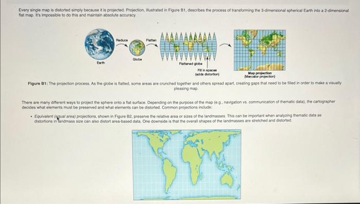

flat map. It's impossible to do this and mairiain absolute accuracy Figure B1: The projection process. As the globe is fatted, some areas are crunched together and others spread apst, creating gaps that need to be fliled in order to make a visually pleasing map. There are many different ways to project the sphere onto a tat surtace. Depending on the purpose of the map (e. 9 , navigation vis. comstunication of therratic data), the cartographer decides what elements musi be preserved and what elements can be distorted. Common projections include: - Equivalent (guual area) projections, shown in Figure B2, preserve the relative area or wizes of the landmasses. This can be important when analyzing thematic data as ditsortons in fandmass size can also distort area-based data. One cownside is that the overal shapes of the landimasses are stretched and distoried.
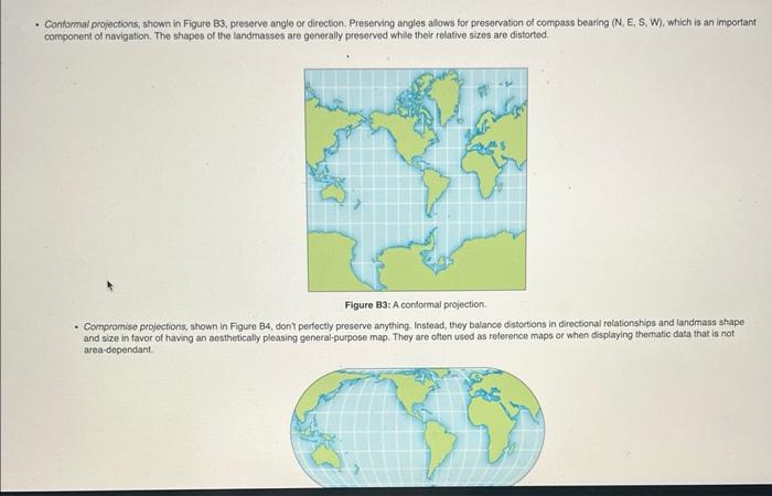
- Conformal projections, shown in Figure B3, preserve angle or direction. Preserving angles allows for presorvation of compass bearing (N. E, S. W), which is an important component of navigation. The shapes of the landmasses are generally preserved while their relative sizes are distorted. Figure B3: A contormal projection. - Compromise projections, shown in Figure B4, donY perfectly preserve anything. Instead, they balance distortions in directional relationships and landmass shape and size in favor of having an aesthetically pleasing general-purpose map. They are often used as reference maps or when displaying thematic data that is not area-dependiant.
dramaticaly of Herent between the conformal and equivalent area projoctions. This may not matter il yoc're trying to saif from North America to England, but a certainly matters when thinking about the divion of ternsory among political pcwers. Consequently, its important to make note of the projection choice, particularly when analyzing maps on a glotal scale. Consider Figure B5 and the lollowing scenario. Three students want to understand haw the worid's population is distributed. To aid in their work, they each create a map showing world population density. Each student uses a different peojection fype for his or her map; Student one uses an equivalent or equal area projecton, stutent two uses a contoimal projection, and student three uses a compromise projection. Student one's maps Equivalent or equal area projection Student fwo's mapi Conformal projectoon
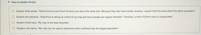
View Available Hint(s) Student three states. "North America and South America are about the same size. Because they also have similar shading. I expect that they havo about the same pocutation. Student two declares, "Antarctica is taking up a third of my map and has 0 people per square kilometec, Therefore, a third of Earth's land is unpopelated" Student throe says, "My map is the least distorted. \( { }^{*} \) Student one caims, My map can be used to determine which continent has the largest population"
Expert Answer
Ans. Student 1 is correct since it looks similar in population density as